Oregon Coast Trail Maps
Overview Maps highlight the main points of interest along the Oregon Coast Trail. Detail maps allow for more information such as recommended route, mileage, tide information, and protected areas.
For more planning and logistic information, visit the “Explore by Section” page.
A variety of additional mobile GPS mapping apps that will help you plan and navigate the Oregon Coast Trail and adjacent trails are listed below:
FarOut - OCT specific guide for the entire trail.
onX Backcountry - Offline GPS mapping app for hiking and biking throughout the U.S. Good option for section hiking the OCT and exploring nearby/adjacent trails.
Overview Maps
Maps are listed from North to South.

Overview 1: North Coast
Fort Stevens State Park to Cape Lookout State Park
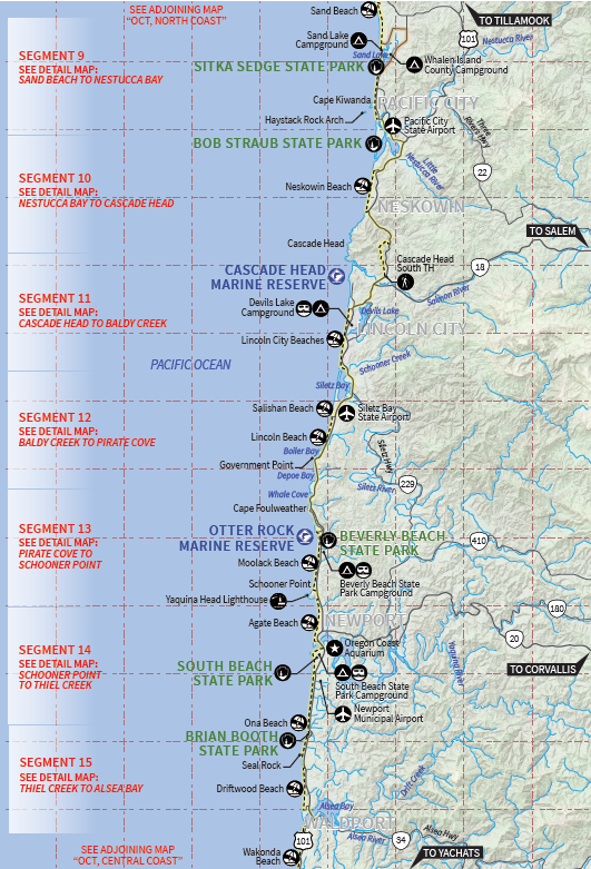
Overview 2: North Central Coast
Sitka Sedge State Park to Waldport
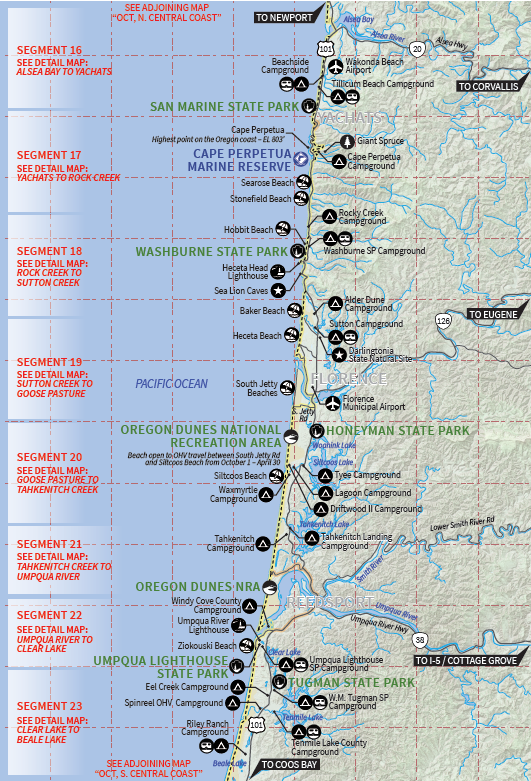
Overview 3: Central Coast
Yachats to Tugman State Park

Overview 4: South Central Coast
Oregon Dunes National Recreation Area to Humbug Mountain State Park
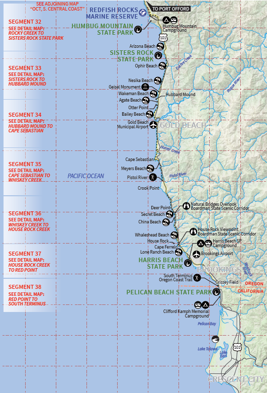
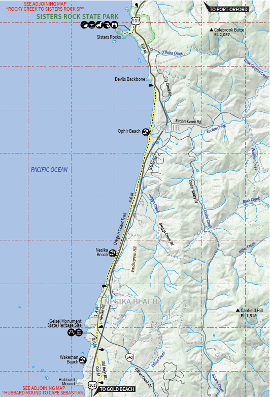
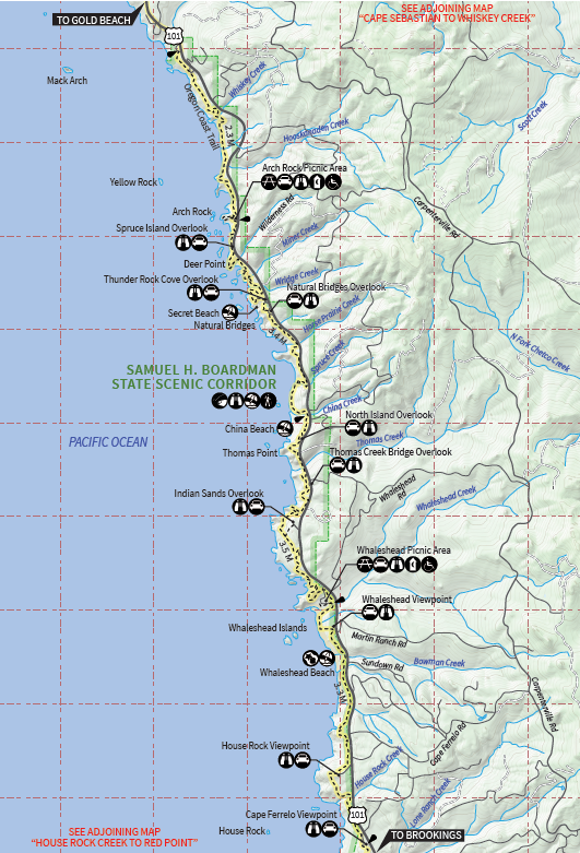
Overview 5: South Coast
Humbug Mountain State Park to California Border
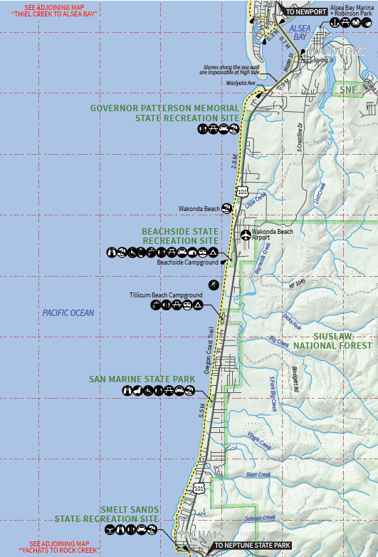
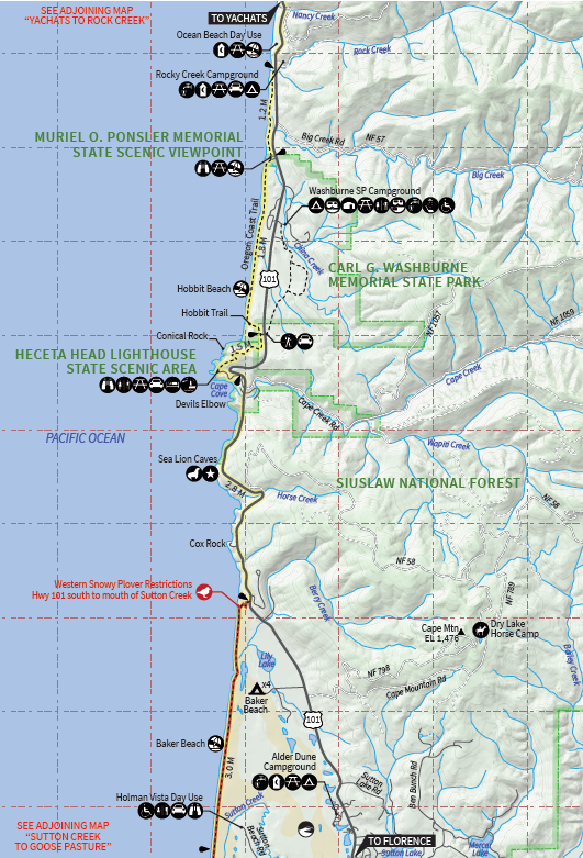
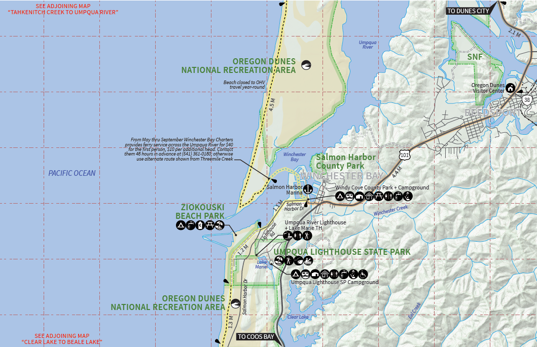
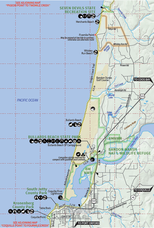
Detail Maps
Maps are listed from North to South.